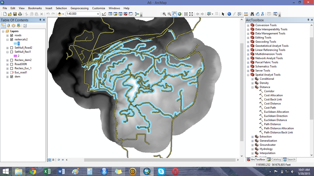
Before I begin installing exclosures, I have to determine where to place them. I use mapping software called ArcMap to look at different land characteristics and property boundaries. If my study results show that deer in wolf areas do not eat as much of species x, then I need to be sure it is because there are wolves there and not because all of my plots in the wolf areas in on north-facing hillsides, for instance. So, I use maps to make sure that hydrology, aspect, slope, roads, and plant communities are similar in the two study areas and that the only difference between the plots in the wolf-present and non-wolf area is the presence of wolves.
I also use the software to help with field navigation. I can use the software to export my survey points and import them to GPS units to find the sites in the field. While GPS units are handy for returning to the same exact point repeatedly, they are still no substitute for paper maps for navigation. Mapping software allows me to map elevation, vegetation, or other distinguishing characteristics to help in getting to and from study sites by car and foot.
Mapping and study design are an important facet of a sound research study. By preparing in advance, I will be able to maximize efficiency and safety in the field and minimize resource use.
by: Apryle Craig
This summer, I will be installing deer exclosures in wolf-present and non-wolf areas of northeastern Washington to investigate the impacts of recolonizing wolves on deer herbivory. At each study site, there will be two vegetation plots: one inside a fence protected from deer browse, and one outside of the fence exposed to deer browse. Each winter, deer consume woody plants that stick up above the snow. In the spring, I will measure the plants in all plots to see how much the deer ate during the winter. By comparing plants inside and outside the fences across wolf-present and non-wolf areas, I can determine if wolves are influencing deer herbivory.
This summer, I will be installing deer exclosures in wolf-present and non-wolf areas of northeastern Washington to investigate the impacts of recolonizing wolves on deer herbivory. At each study site, there will be two vegetation plots: one inside a fence protected from deer browse, and one outside of the fence exposed to deer browse. Each winter, deer consume woody plants that stick up above the snow. In the spring, I will measure the plants in all plots to see how much the deer ate during the winter. By comparing plants inside and outside the fences across wolf-present and non-wolf areas, I can determine if wolves are influencing deer herbivory.
 RSS Feed